Today we made a brief visit to one of most popular getaways for visitors to Auckland, Rangitoto Island.
Lying to the north-east of Auckland, 8km the other side of Devonport, we had (quite unknowingly) been looking out over Rangitoto Island while eating our lunch on Devonport’s North Head just a couple of days earlier.
In Maori, Rangitoto means Bloody Sky, which makes sense when you consider that this 5.5km-wide island is home to a 260 metre-tall volcano. This is the tallest, and youngest, of the 48 volcanoes that surround Auckland.
With an eruption occurring, on average, every 1,000 years, and 600 years having passed since Rangitoto’s last eruption, we felt fairly safe spending an afternoon walking up to the crater to enjoy the 360 degree views across the Hauraki Gulf and back over to the Auckland CBD.
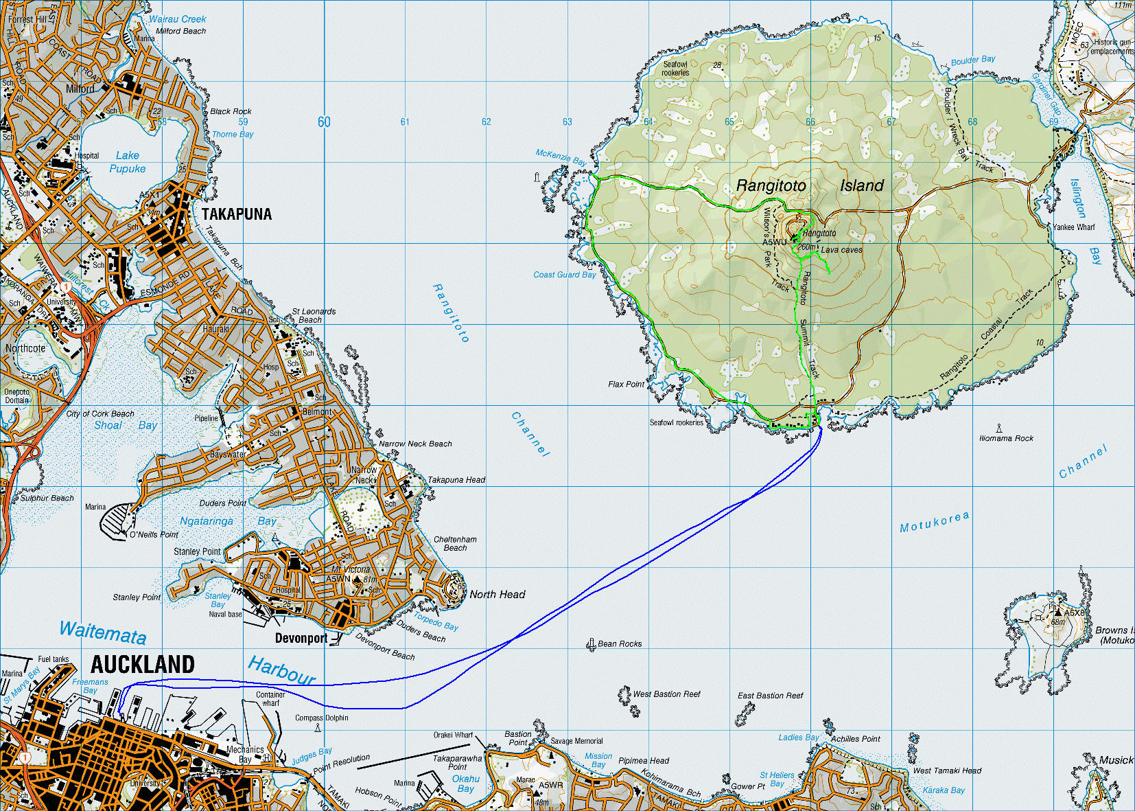
The ferry crossing to Rangitoto Island takes 25 minutes from Downtown Auckland. Whilst the ferry to Devonport cost us just a few dollars each, that is primarily a service for residents, whilst the only reason to go to Rangitoto is sight-seeing. Hence tickets costing ten times as much!!
The first half of the 2.2km walk from the wharf to the volcano summit rises very gently, with the second half becoming increasingly steep. Although it was nothing like as strenuous as the walk we had made up Mount Batur in Bali a few weeks earlier, we got just as sweaty as we did on that occasion as this was the hottest day of the summer so far in Auckland, and we were making our ascent in the sweltering early afternoon heat.

As well as getting a sweat on, we got quite dirty during the ascent, as we were often walking on volcanic ash. We crossed numerous old lava flows, with hard black rocks cutting a big gash through what is otherwise lush green forest.
From time to time, we spotted a rat or stoat trap alongside the trail, a very common sight in all of the national parks we have visited since arriving in New Zealand. Rangitoto is predator-free, so these traps are presumably used for monitoring, rather than with the expectation of actually catching something.
As early as 1800, Rangitoto was used as a lookout. During the first and second world wars, as fears of a Russian invasion intensified, the island was closed to the public after a number of U.S. troops were stationed there, and it was used to store naval mines. At the summit, there are still some reminders of the island’s military past, with an observation hut and an underground bunker.


Just to prove that we really were walking around a volcano, we took a quick peek down into the crater, though it’ll probably be another 400 years before there’s much to see down there except a lot of trees!

After spending a few minutes admiring the stunning views (which – as usual – are done no justice by the photographs which we took), we began our descent, making a brief diversion to visit the “lava cave”, a short underground tunnel which presented a few health and safety concerns for anyone over about 3 foot tall!

Though we’d spent less than three hours on the island, we were very hot and rather sweaty by the time we got back to the ferry wharf. It was very tempting to join the dozen or so visitors who were taking it in turns to dive off the jetty into the cool waters below, but we had no towels and no change of clothes, so – while we waited for the last ferry of the day – we had to settle for some sun-bathing and the chance to make plans for a cocktail once we got back into the city.